- 0 Shopping Cart


Haiti Earthquake 2010
Haiti earthquake case study.
A 7.0 magnitude earthquake .
The earthquake occurred on January 12th, 2010, at 16.53 local time (21.53 GMT).
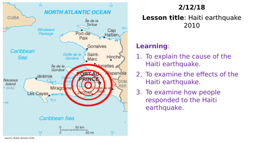
The earthquake occurred at 18.457°N, 72.533°W. The epicentre was near the town of Léogâne, Ouest department, approximately 25 kilometres (16 mi) west of Port-au-Prince, Haiti’s capital. The earthquake’s focus was 13km (8.1 miles) below the Earth’s surface.
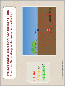
Haiti is situated at the northern end of the Caribbean Plate, on a transform (slip/conservative) plate boundary with the North American Plate. The North American plate is moving west. This movement is not smooth, and there is friction between the North American Plate and the Caribbean Plate. Pressure builds between the two plates until released as an earthquake.
A map to show the location of Haiti in relation to tectonic plates. Source BBC.
The epicentre of the earthquake was 16km southwest of Port-Au-Prince. The earthquake was caused by a slip along an existing fault (Enriquillo-Plaintain Garden fault).
A map to show the location of the epicentre of the earthquake
Primary Effects
As of February 12th 2010, an estimated three million people were affected by the quake; the Haitian Government reports that between 217,000 and 230,000 people died, an estimated 300,000 were injured, and an estimated 1,000,000 were made homeless. They also estimated that 250,000 residences and 30,000 commercial buildings had collapsed or were severely damaged.
Secondary Effects
- Two million people were left without water and food.
- Regular power cuts occurred.
- Crime increased – looting became a problem and sexual violence escalated.
- People moved into temporary shelters.
- By November 2010 there were outbreaks of cholera.
Immediate Responses
- Due to the port being damaged, aid was slow to arrive.
- The USA sent rescue teams and 10,000 troops.
- Bottled water and purification tablets were provided.
- 235,000 people were moved away from Port-au-Prince to less-damaged cities.
- £20 million was donated by The UK government.
Long-term Responses
- As one of the poorest countries on Earth, Haiti relied on overseas aid.
- Although the response was slow, new homes were built to a higher standard. Over one million people still lived in temporary shelters one year after the earthquake.
- The port needed rebuilding, which required a large amount of investment.
So, why did so many people die in the Haiti earthquake? There are several reasons for this:
- The earthquake occurred at shallow depth – this means that the seismic waves must travel a smaller distance through the Earth to reach the surface to maintain more energy.
- The earthquake struck the most densely populated area of the country.
- Haiti is the poorest country in the Western Hemisphere
- The buildings in Port-Au-Prince and other areas of Haiti were generally in poor condition and were not designed or constructed to be earthquake-resistant.
- Three million people live in Port au Prince; most live in slum conditions after rapid urbanisation .
- Haiti only has one airport with one runway. The control tower was severely damaged in the earthquake. The port is also unusable due to damage.
- Initially, aid had been piling up at the airport due to a lack of trucks and people to distribute it. Water and food have taken days to arrive, and there is not enough to go around.
- Rescue teams from around the world took up to 48 hours to arrive in Haiti due to the problems at the airport. As a result, local people have had to use their bare hands to try and dig people out of the rubble.
- There has been a severe shortage of doctors, and many people have died of injuries like broken limbs.
The BBC News website has a comprehensive overview of the earthquake here . In addition, the BBC has produced an excellent article titled Why so many people died in the Haiti earthquake? and provides comparative data with similar earthquakes.
Premium Resources
Please support internet geography.
If you've found the resources on this page useful please consider making a secure donation via PayPal to support the development of the site. The site is self-funded and your support is really appreciated.
Related Topics
Use the images below to explore related GeoTopics.
Previous Topic Page
Topic home, next topic page, share this:.
- Click to share on Twitter (Opens in new window)
- Click to share on Facebook (Opens in new window)
- Click to share on Pinterest (Opens in new window)
- Click to email a link to a friend (Opens in new window)
- Click to share on WhatsApp (Opens in new window)
- Click to print (Opens in new window)
If you've found the resources on this site useful please consider making a secure donation via PayPal to support the development of the site. The site is self-funded and your support is really appreciated.
Search Internet Geography
Latest Blog Entries
Pin It on Pinterest
- Click to share
- Print Friendly
285. Haiti Earthquake 2010
Description.
In this Geography Factsheet you will find: • Haiti earthquake – The physical event. • Immediate impact. • Response. • Disaster management cycle. • The long-term recovery plan for Haiti.
Download Type
.PDF (pdf) 325.199 KB
Publication Date
Issn / isbn.
ISSN: 1351-5136
Copyright Disclaimer
The materials published on this website are protected by the Copyright Act of 1988. No part of our online resources may be reproduced or reused for any commercial purpose, or transmitted, in any other form or by any other means, without the prior permission of Curriculum Press Ltd.
Similar Resources
What our customers say, find exactly what you’re looking for..
- Popular Searches
- A Level Media Studies
- A Level Environmental Science

Work with us
Get in touch.
- © 2024 Curriculum Press
- | Terms & Conditions
- | Privacy & Cookies |
- Website MadeByShape
Tectonic Mayhem
2010 has been a very eventful year for earthquakes and volcanoes.
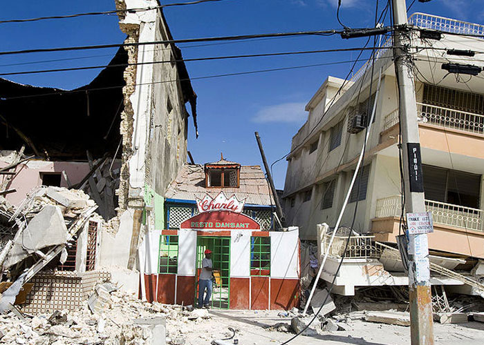
January (earthquake)
Haiti: over 230,000 people were killed and over 1 million were injured when a 7- magnitude earthquake struck.
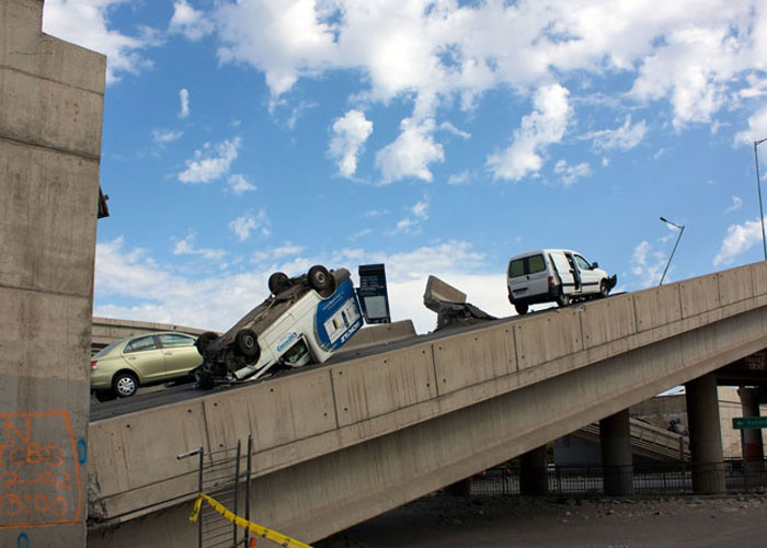
February (earthquake)
Chile: about 452 people were killed when an 8.8 - magnitude earthquake struck.
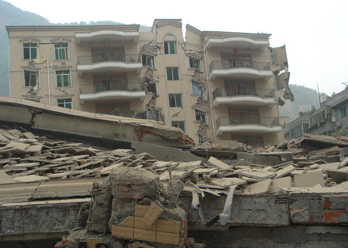
April (earthquake)
China: at least 400 people died after a 6.9 - magnitude earthquake struck western China's Qinghai province.
April – May (volcano)
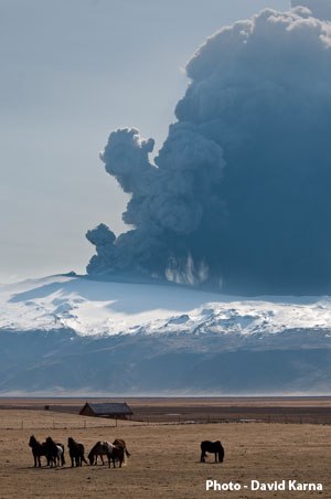
Iceland: all flights to and from the United Kingdom were stopped because of volcanic ash coming from a volcano in Iceland.
Did you know?

The size of an earthquake most often described on the news is measured using a scale invented by Charles Richter who was an American scientist. The Richter scale goes from the weakest (magnitude 1) to the strongest (magnitude 9).
| Great | 8.0+ | 1 |
| Major | 7.0-7.9 | 18 |
| Large (destructive) | 6.0-6.9 | 120 |
| Moderate (damaging) | 5.0-5.9 | 1,000 |
| Minor (damage slight) | 4.0-4.0 | 6,000 |
| Generally felt | 3.0-3.9 | 49,000 |
| Potentially perceptible | 2.0-2.9 | 300,000 |
| Imperceptible | less than 2.0 | 600,000+ |
Flash Player Required
What causes earthquakes and volcanoes.
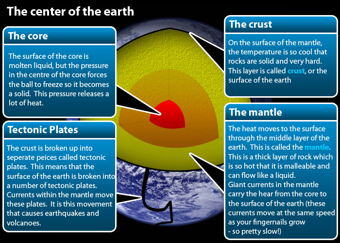
Geographers try to understand how earthquakes and volcanoes happen by using the plate tectonics model. This model explains what is happening on the surface by looking inside the earth.
Nearly all major earthquakes and volcanoes happen near the edges of tectonic plates. Iceland is a place where two plates are moving apart. Haiti, Chile and China are places where plates have been forced into each other.
Earthquakes are waves of energy caused when the tectonic plates bump into each other. A break or fracture within a layer of rock is called a fault. The size of the area of rock that breaks and moves causes the strength of the resulting earthquake: the bigger the area of rock that breaks, the bigger the earthquake. For example, if an area of rock the size of Wales breaks and moves that would result in a magnitude 8 earthquake.
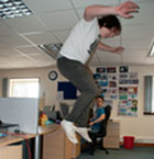
An earthquake is a shaking in the earth. A magnitude 1 earthquake is similar to the shaking produced when an average-sized man jumps from a 1 metre high table top onto the ground. Only sensitive instruments called seismometers can detect these. Each level of magnitude is 10 times bigger than the previous one.
Why did the Haiti earthquake kill more than the Chilean earthquake?
There are a number of reasons why this happens, but to understand them we need to know a bit more about how an earthquake happens.
We already know that an earthquake happens when an area of rock within the earth breaks and moves along a fault. This point is called the earthquake focus . Waves of energy spread out in a circular pattern when they reach the surface (the point on the surface directly above the focus is called the epicentre). The waves then spread out across the surface just like ripples in a pond. It is these surface waves that cause the damage.
If the focus is close to the surface then more of the energy reaches the surface. The energy level drops as the waves travel through the rocks and as a result the waves get smaller. In Haiti the focus was very shallow – less than 15km so nearly all of the energy reached the surface.
The volcano that brought UK air travel to a stop is located at a point where two plates move apart. Beneath the surface a current in the mantle is rising towards the surface. As it rises the pressure drops and some of the minerals melt to produce a mixture of liquid rock (magma) and dissolved gas.
When this reaches the surface it is like a violently shaken bottle of pop that explodes when the lid is taken off. All the overlying rock and magma is pulverised into ash and thrown high into the atmosphere.
Unusual weather conditions carried the ash over the UK causing the chaos.
Population density
The next important point is population density. In Haiti the epicentre was very close to the capital city Port au Prince; as a result the earthquake affected a city of over 2 million people.
Human geography
The final factor is wealth; Haiti is much poorer than the other countries so most buildings were not lifesafe. Lifesafe buildings have reinforced corners where columns, walls and floors meet.
Lifesafe buildings do not collapse or flatten but they require 10 per cent more materials to build and are 10-15 per cent more expensive to build. After the earthquake Haiti did not have the emergency services to cope so many more people were killed. These are an example of how human geography made a physical geography disaster even worse.
So ultimately the danger from an earthquake is not so much a case of how big it is but where it happens - the most dangerous earthquakes happen close to:
The surface
Areas of high population density (cities)
Poor countries
Do some research on either an earthquake or a volcano in 2010.
Produce a news report on what happened and why it happened. Include details of both the physical geographical reasons and human reasons for the disaster.
Think about this – imagine trying to draw a graph to show the levels of magnitude.
Level one could be shown as a bar 1mm high, level 2 would be 10mm (1cm), level 3 would be 10cm, level 4 would be 100cm (1 metre (m), level 5 would be 10m, level 6 would be 100m, level 7 1000m (1km), level 8 would be 10km & level 9 would be 100km! How many pieces of graph paper would you need to draw that graph?
Related Articles...
The Ryder Cup
Tourism in Wales
- International
- Education Jobs
- Schools directory
- Resources Education Jobs Schools directory News Search
Haiti 2010 earthquake case study
Subject: Geography
Age range: 11-14
Resource type: Lesson (complete)
Last updated
30 March 2021
- Share through email
- Share through twitter
- Share through linkedin
- Share through facebook
- Share through pinterest

Tes paid licence How can I reuse this?
Get this resource as part of a bundle and save up to 60%
A bundle is a package of resources grouped together to teach a particular topic, or a series of lessons, in one place.
Tectonic processes and hazards
Ten lessons on plate tectonics; processes, hazards and the management of these hazards. The bundle covers everything in this unit of study. All the resources you need to deliver this unit are included. The bundle include case studies on earthquakes and volcanoes as well. The lessons in the bundle are all differentiated and include challenge task. As a matter of fact these lessons can be used with GCSE groups with minor tweaking.
Volcanoes and earthquakes
Your rating is required to reflect your happiness.
It's good to leave some feedback.
Something went wrong, please try again later.
This resource hasn't been reviewed yet
To ensure quality for our reviews, only customers who have purchased this resource can review it
Report this resource to let us know if it violates our terms and conditions. Our customer service team will review your report and will be in touch.
Not quite what you were looking for? Search by keyword to find the right resource:
Resources you can trust
Cause, effect and response of the 2010 Haiti earthquake
All reviews
Have you used this resource?
Alex Phillips Moseley
Resources you might like

COMMENTS
Haiti Earthquake Case Study. Subject: Geography. Age range: 14-16. Resource type: Worksheet/Activity. File previews. pdf, 676.67 KB. A case study of the Haiti Earthquake with worksheet for GCSE students. Also included an additional activity about effects of earthquakes to be linked to Haiti and MEDC/LEDC comparison.
The earthquake occurred at 18.457°N, 72.533°W. The epicentre was near the town of Léogâne, Ouest department, approximately 25 kilometres (16 mi) west of Port-au-Prince, Haiti's capital. The earthquake's focus was 13km (8.1 miles) below the Earth's surface.
When the earthquake struck Haiti, it caused massive devastation for Haiti and its people. Haiti is known for its rich culture, but it is also known as being a place rich in natural disasters. When introducing Haiti to your learners, it is impossible not to mention the 7.0 magnitude earthquake that hit Haiti at about 4:53 pm on the 12th of January in 2010. To get your learners to learn more ...
You can use this informative PowerPoint to learn all about the devastating earthquake in Haiti in 2010. ... geography earthquake case studies . KS2 Haiti Fact File. Haiti Earthquake Fact File Template ... KS2 Geography: Extreme Earth: Earthquakes Year 3 Lesson Pack 4. Earthquakes Differentiated Reading Comprehension Activity. Earthquakes ...
Haiti Earthquake - Case Study - GCSE Geography. 17 terms. Isabel_Cook9. Preview. the impact of Thatcherism 1979-1987 ~ society flashcards. 99 terms. bramm205. Preview. ... Nepal Earthquake Case Study. 9 terms. daniel_stainsby. Preview. Agriculture and industry, China. 32 terms. AlexanderMcDonald05. Preview. CIVI BRIT INDIA DATES AND NAMES. 23 ...
- 5 years after the earthquake, 500,000 victims were still living in temporary shelters without electricity, plumbing or sewage (this lack of sanitation was the foundation of the ongoing cholera outbreak) - As of 2013, between 23 major charities, total relief funding of $3.5 billion had been donated - The number of people living in relief camps since the earthquake was 1.6 million and the ...
This resource is a case study of the Haiti earthquake which occured in 2010. It helps students summarise the causes and effects of the earthquake using different geographical skills. It could be used as an assessment task, a stand alone question sheet, or a homework task to recap knowledge.
Government was already unstable before the earthquake. National palace, a symbol of authority, collapsed. Catastrophic. 240,000 people lost their lives. 300,000 injured. More than 1 million homeless. Approx. 80% of the structures in Port-au-Prince were destroyed.
Haiti Earthquake Revision Case Study. Subject: Geography. Age range: 14-16. Resource type: Assessment and revision. File previews. pptx, 44.91 KB. GCSE AQA Geography (New Specification) Unit 1: The Challenge of Natural Hazards. Blank Haiti Case Study sheet for LIC Natural Hazard. Students complete with their own knowledge to create a clear ...
Description. In this Geography Factsheet you will find: • Haiti earthquake - The physical event. • Immediate impact. • Response. • Disaster management cycle. • The long-term recovery plan for Haiti.
You can use this informative PowerPoint to learn all about the devastating earthquake in Haiti in 2010. Filled with information about why and where it happened along with the aftermath, this resource is perfect when learning about natural disasters around the world. ... geography earthquake case studies . haiti . earthquake case study . haiti ...
Tectonic Mayhem. KS 2 KS 3. 2010 has been a very eventful year for earthquakes and volcanoes. January (earthquake) Haiti: over 230,000 people were killed and over 1 million were injured when a 7- magnitude earthquake struck. February (earthquake) Chile: about 452 people were killed when an 8.8 - magnitude earthquake struck. April (earthquake)
Explore the country of Haiti through this informative and illustrated A4 fact file. The fact file is aimed at KS2 children and contains a variety of facts about topics such as: location; wildlife and vegetation; music; physical and human features. Find out what the capital city of Haiti is called, what currency is used, the estimated population number and what country it shares a land border ...
Lesson covers Haiti's background, a youtube video with a timeline of events before, during and after the earthquake, and a focus on the impacts and responses to the ... Earthquake in Haiti 2010 - case study of impacts & responses (AQA The Challenge of Natural Hazards) Subject: Geography. Age range: 14-16. Resource type: Lesson (complete)
Worksheet. Student activity. Continents. North America. Used with GCSE students, this sheet is designed to hold all of the case study information in a visually attractive way. The sheet is particularly useful for revision when enlarged to A3. 230.88 KB. Free download. 835.95 KB.
File previews. pptx, 1.21 MB. This is a case study lesson on the Haiti 2010 earthquake. The lesson is planned to GCSE standards but can be used for KS3 as well. Key facts about the lesson are: 1. The content covered by the lesson are; location of Haiti, identifying the plate boundary that caused the earthquake, the primary and secondary impact ...
This resource highlights the causes, effects and responses to the 2010 Haiti earthquake. Students categorise a series of images before completing a colour-coding task to summarise this. Students then complete a written task creating a news bulletin about the earthquake, which can be peer or self assessed. Two possible extension activities are ...